If your CloudStation version is 2309.0 or newer, please refer here
If your CloudStation version is 2305.0 or older, please refer here
CloudStation 2309.0 and newer version
You can entirely process your data (from the SBET to the export) directly in CloudStation.
Make sure the base is imported with the correct frame GDA2020 at epoch 2020.0 - as long as you have the base coordinates processed within this frame.

Set the export mapping frame to datum GDA2020 epoch 2020.0 and vertical system to orthometric AUSGeoid2020 - as printscreen below :

Process the data as per normal using your above generated sbet.
Export your data using a custom coordinate projection. From the export panel, click on the 'Coordinates' and select "GDA2020 / MGA zone" according to your MGDA zone. See below:

CloudStation 2305.0 and older
From POSPac :
Make sure the base is imported with the correct frame GDA2020 at epoch 2020.0 - as long as you have the base coordinates processed within this frame.
Make sure your lever arms are correctly set and standard deviation is locked (value set to <0.03m)
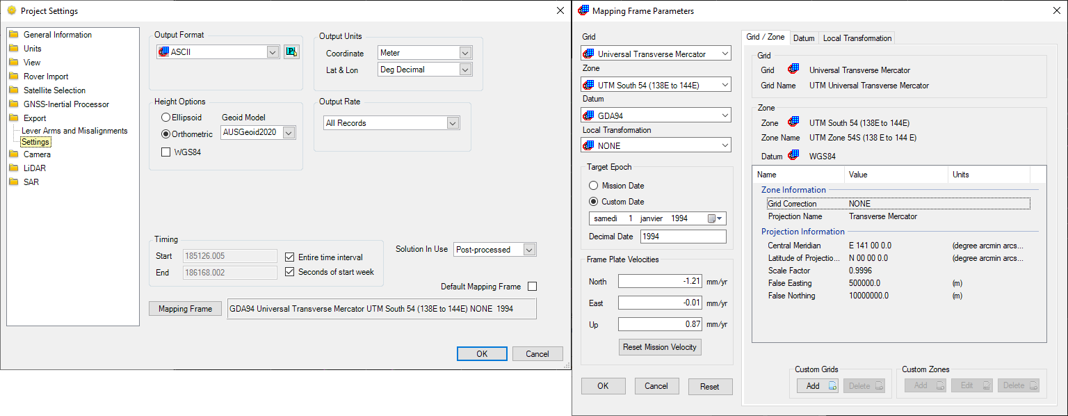
Set the export mapping frame to datum GDA94 epoch 1994.0 and vertical system to orthometric AUSGeoid2020 - as printscreen below :
From CloudStation :
Process the data as per normal using your above generated sbet.
Export your data using a custom coordinate projection. From the export panel, click on the 'Coordinates' and select 'Other'. See below.
Once in the Coordinate Reference System, search the project '7856' and select 'Create custom projection based on this one' icon. (the below image searches for 7854 instead)

Once you are in the 'New custom CRS' window, give it a name 'Custom GDA2020 7856' and copy and paste the below block :
+proj=pipeline

+step +proj=utm +zone=56 +south +ellps=GRS80

+step +inv +proj=utm +zone=56 +south +ellps=GRS80

+step +proj=push +v_3

+step +proj=cart +ellps=GRS80

+step +proj=helmert +x=0.06155 +y=-0.01087 +z=-0.04019 +rx=-0.0394924 +ry=-0.0327221 +rz=-0.0328979 +s=-0.009994 +convention=coordinate_frame

+step +inv +proj=cart +ellps=GRS80

+step +proj=pop +v_3

+step +proj=utm +zone=56 +south +ellps=GRS80
It should look as below:
