The CloudStation offers 5 different point cloud formats and 1 raster format, from the Export tab:

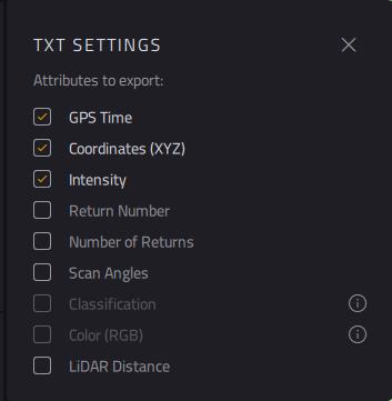
- ASCII files, with configurable fields (Time,X,Y,Z Coordinates, Intensity, Return Number, Number of returns, Scan Angles, Range) and eventually, if the point cloud had been classified or colorized, Classification and RGB Color.
- las 1.2 or las 1.4 , binary standard point cloud format, as defined by the American Society for Photogrammetry and Remote Sensing (ASPRS)
https://www.asprs.org/wp-content/uploads/2010/12/asprs_las_format_v12.pdf
https://www.asprs.org/wp-content/uploads/2019/07/LAS_1_4_r15.pdf
- laz 1.2 or laz 1.4 , which are compacted version of the las files.
- Raster : when exporting a Digital Model rather than a point cloud, all Digital Model proposed (DTM,DSM, DHM) would be exported as Geotiff (.tif) format.
